Share with others:
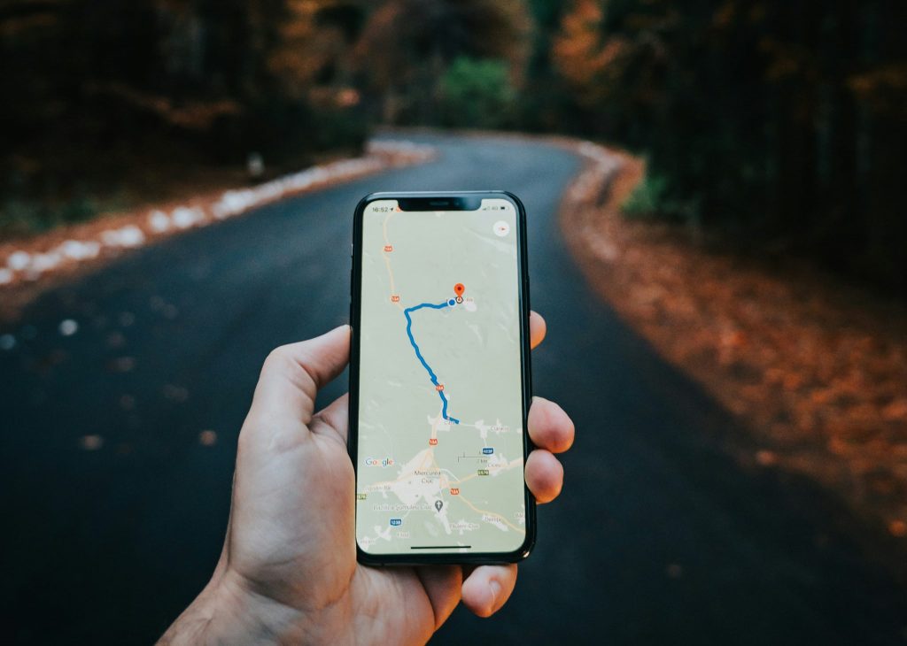
8 useful tricks in Google Maps
A big advantage of the Google Maps application is that you can easily avoid traffic jams, obstacles on the road, and eventually even tolls with their help.
If you're looking for tricks to make Google Maps even more useful in your hands, we've rounded up a few.
Maps have unimaginable possibilities and it's impossible to cover them all in one article, so here are a few that we think are really useful and that you might not be familiar with.
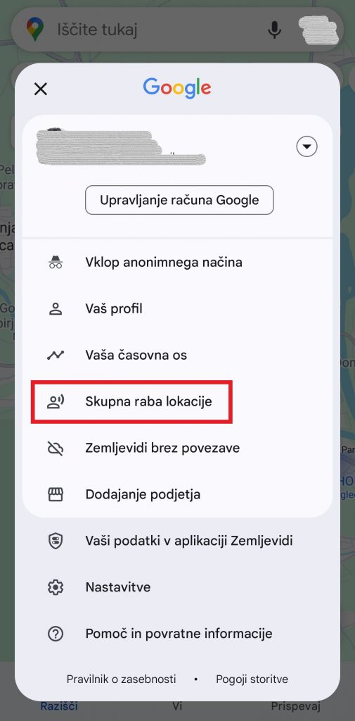
Share location
One of the best features of Google Maps is sharing your location with friends or anyone. Let's say you are somewhere with friends and at some point you get separated and then want to get back together. This can be quite awkward, especially in unfamiliar places. Even a call can't solve this as effectively as sharing a location that updates and you can track in real time.
In Maps, tap your icon in the search bar at the top right and select "Location Sharing" from the menu. Then click the “New Share” button. Below you choose with whom you would like to share the location, and above that, for how long (you can choose by hours or until you turn off the function).
Google Maps will share your location with selected contacts who will be able to track your position in the app. When they open Maps, your icon will appear where you are. They'll also be able to choose to have Maps guide them to you.
Mark things
If you are going somewhere and would like to mark what you want to see, you can mark it in Google Maps. Create a list of attractions that you will always have at hand, and everything you mark will also be visible on the map.
On the home page below you have the options "Explore", "You" and "Contribute". Click on "You" to see the lists, and you can also create a new one. You can add cities by clicking on the list and then find what you want in the search engine above. When you tap the found one, it will be saved to the list.
But you can do it a little differently and first search for what you want to find in the main menu, and then tap the place on the map. When you see more information below, swipe right on the "Directions" line and the "Save" option will appear. By tapping on it, you can then choose which list you want to add the location to. When you need it again, the list is accessible on the home screen below under "You", as we wrote at the beginning.
A little practice and the function will be extremely useful on your next vacation.
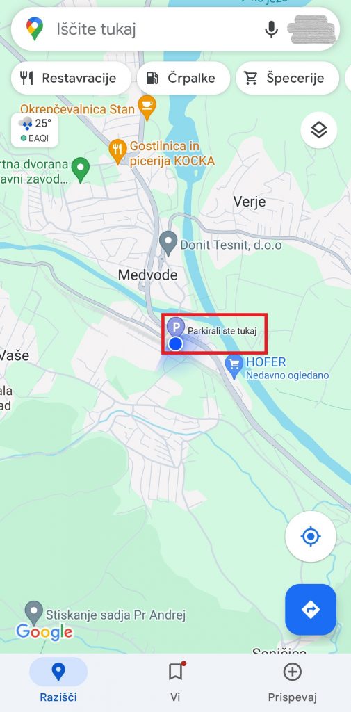
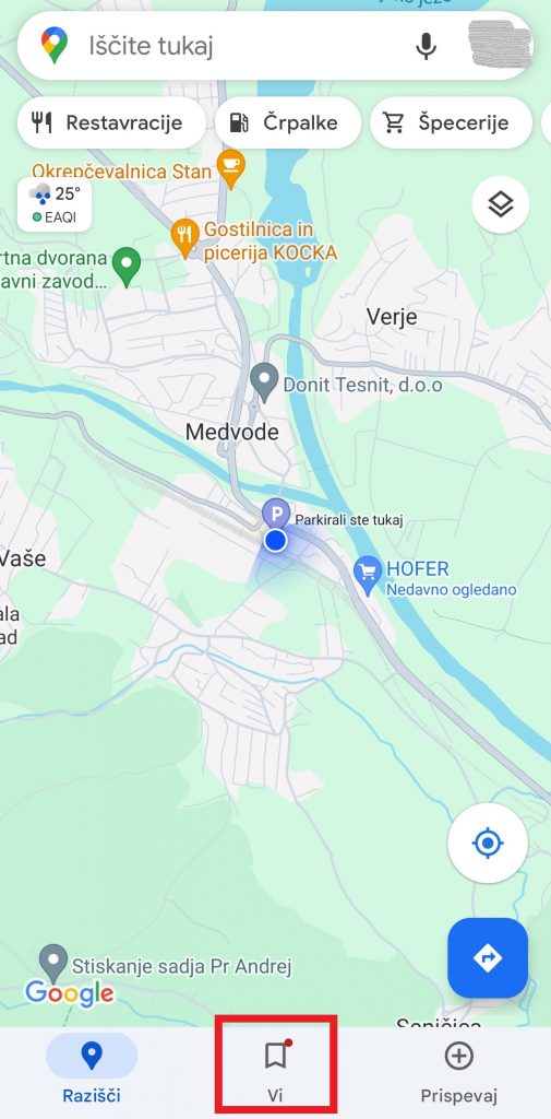
Where did I park?
Especially in places you don't know, it's easy to park your car, but at the end of the day you're looking for it because you don't know exactly where it is. You can avoid this with the simplest and most effective trick. Go to Google Maps. The point where you are is marked with a blue circle. Tap on it and “Save Parking” will also appear among the options. Arranged. The map will now say "You parked here". You can also tap on this and tell the app to take you to the marked location.
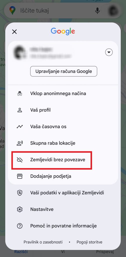
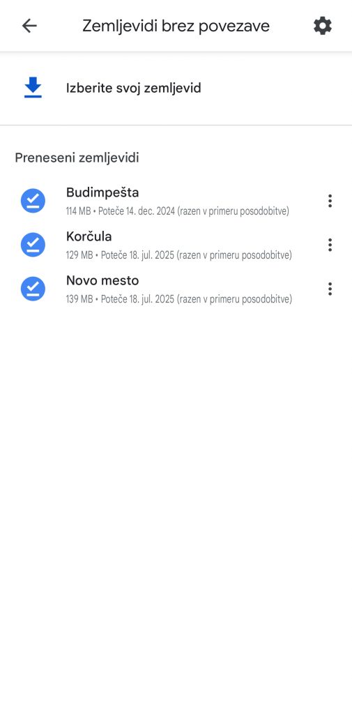
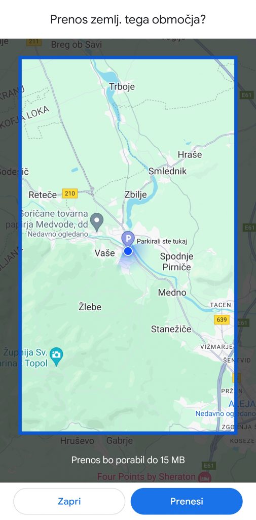
Use Google Maps even offline
If you use the application often, it has surely happened to you that you found yourself in an area where there was no data transfer or mobile network, which can quickly become a problem. But Google Maps has a solution and can work even if you don't have a network.
When you open the Maps app, click on your picture above on the far right of the search bar, then select "Offline Maps" and "Choose your map." Then you select the area that you would like to save even for when data transfer is not available. The size of the area is limited, but quite large, because in this way you can save an area much larger than Slovenia. If this is not enough, you can also save a large number of offline areas.
You can then use these areas in the same way you would use the app with an internet connection - you can zoom in, out, search, and use navigation. Of course, the saved map will not be able to provide real-time traffic information if you don't have a data connection.
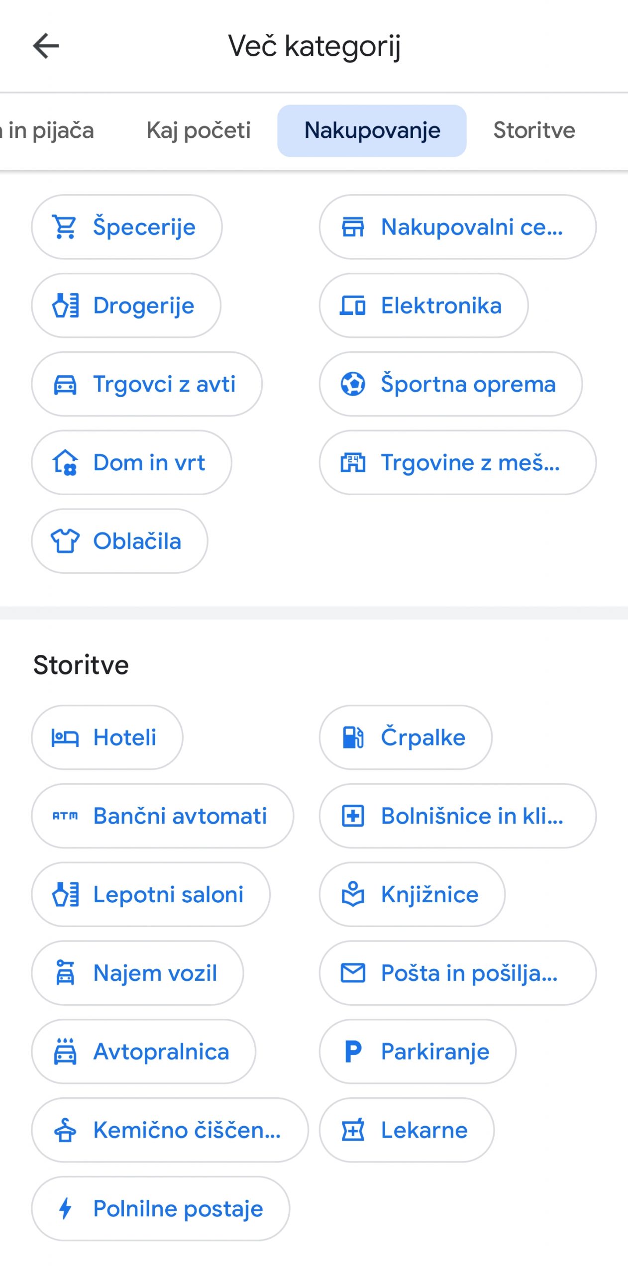
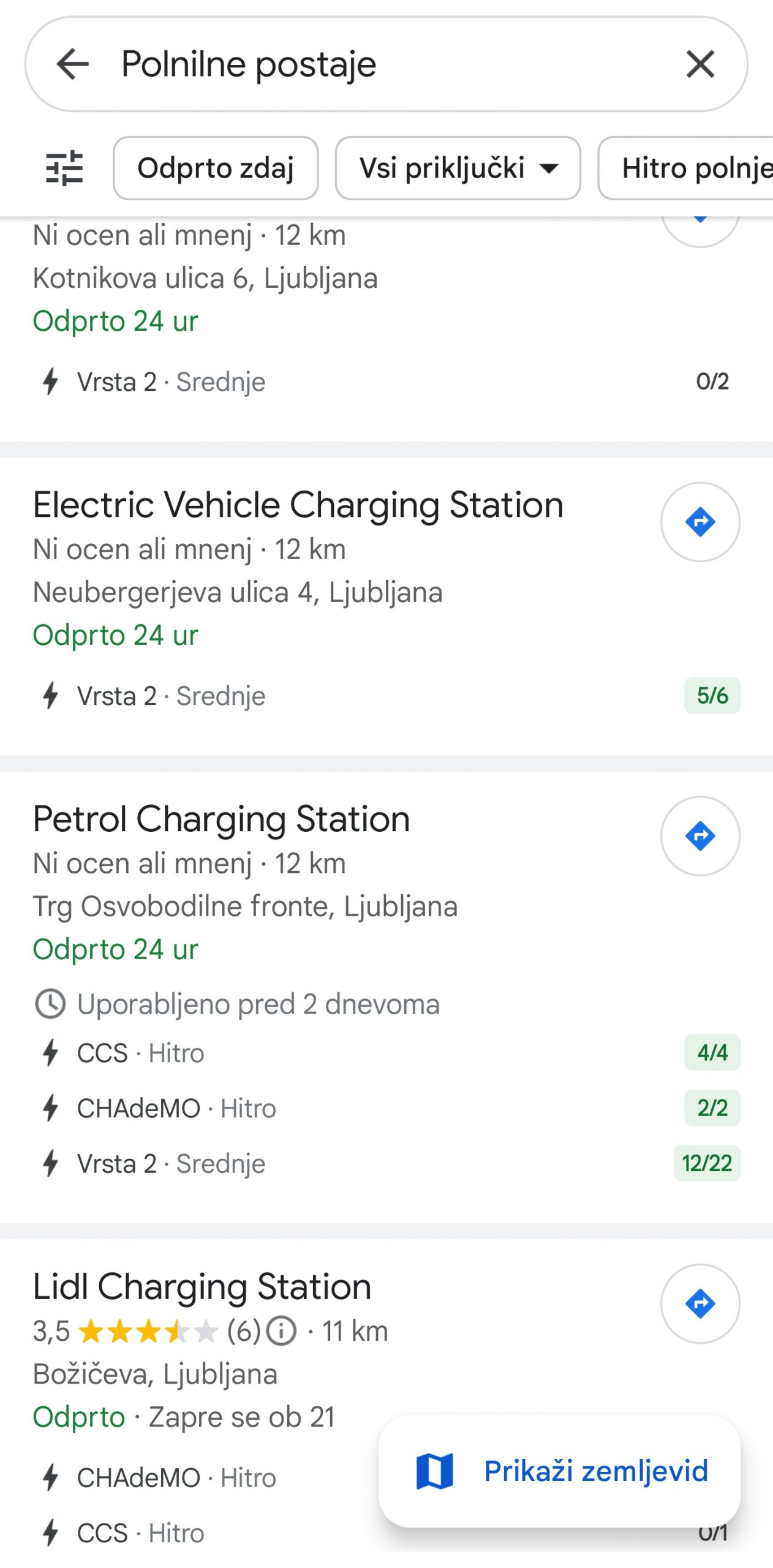
Do you have an electric car and are you looking for a charging station?
Nothing easier. Maps can help you find electric vehicle charging stations along the way. You can even filter your search by the type of connector that is compatible with your vehicle.
First, we tried entering "EV charging" in the search window of the application. That's how we got the most results. Alternatively, under the search window on the home screen, where there are options for "Restaurants", "Hotels" and the like, slide to the right side to "More". Then you have a lot of options (recommended to explore them), including "Charging Stations" (as well as regular "Pumps" if you don't have an electric car). During the journey, you can tap any of them and select it as a stop on the way.
You can also use this trick for hotels, cafes, ATMs, parking lots, attractions...
How do I avoid tolls?
Once you have Google Maps in navigation mode, it says below how much time is left to the end of the route. If you slide that tile up, a menu appears and at the end are settings. Tap on them. If you then scroll down a bit, you'll stop at 'Route Options', which include 'Avoid Tolls', 'Avoid Motorways' and 'Avoid Ferries'. Mark what you want and continue on your way. Just know that the system also remembers this for your further journeys, so next time you mark or unmark again as it suits you on the way.
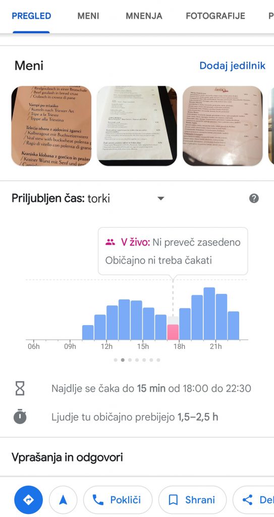
Check for possible crowding
Before heading to an attraction or an area where you expect crowds, check the conditions. If you enter a company, a shopping center... you can click on it in the application, scroll down a bit and check the occupancy by day and hour.
You can also see an orange circle with a graph next to places on the map (for example, the center of Ljubljana), and the inscription "Congested area". If you click on it, you can also view occupancy graphs for individual hours and days of the week and learn more about when the area is most crowded.
Restaurants and options
Let's say you're in some place you don't know. You get hungry and would like to find a good restaurant. We believe that most people know this function, but it will definitely come in handy for someone. When you open Maps, there is a "Restaurants" option under the search engine. Check out their user ratings and reviews. You can also see when they are most busy.
The best thing is that you can call the restaurant or bar directly and from Maps by clicking on the "Call" button. You can also check the schedule. In the editorial office, we use this very often, also in Slovenia, and the data that is entered is generally correct. Some restaurants even have a "Submit Order" option.
Easy navigation at the airport or train station
If you are looking for a specific store in a large shopping center or in transit hubs such as an airport or train station (especially in larger cities), Google Maps has a solution. If you enter the name of the airport or click on it on the map, you will find several tabs at the bottom of the phone screen, and one of them is "Directory". Restaurants and shops are lined up below. When we get to the one we are interested in, click on it and continue by clicking on "Directions". The application will lead us to the desired destination.
We cannot expect the same good result at all world airports, railway and bus stations, but the matter works in principle.